p. 1
Introduction
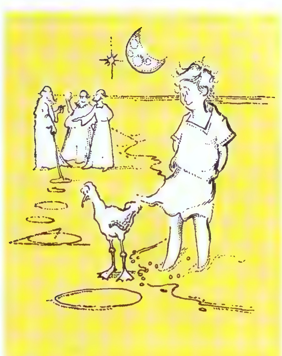
Old Euclid drew a circle
On a sand-beach long ago.
He bounded and enclosed it
With angles thus and so.
His set of solemn graybeards
Nodded and argued much
Of arc and of circumference,
Diameters and such.
A silent child stood by them
From morning until noon
Because they drew such charming
Round pictures of the moon.
Vachel Lindsay
Euclid, the Surfer, and the Spotter
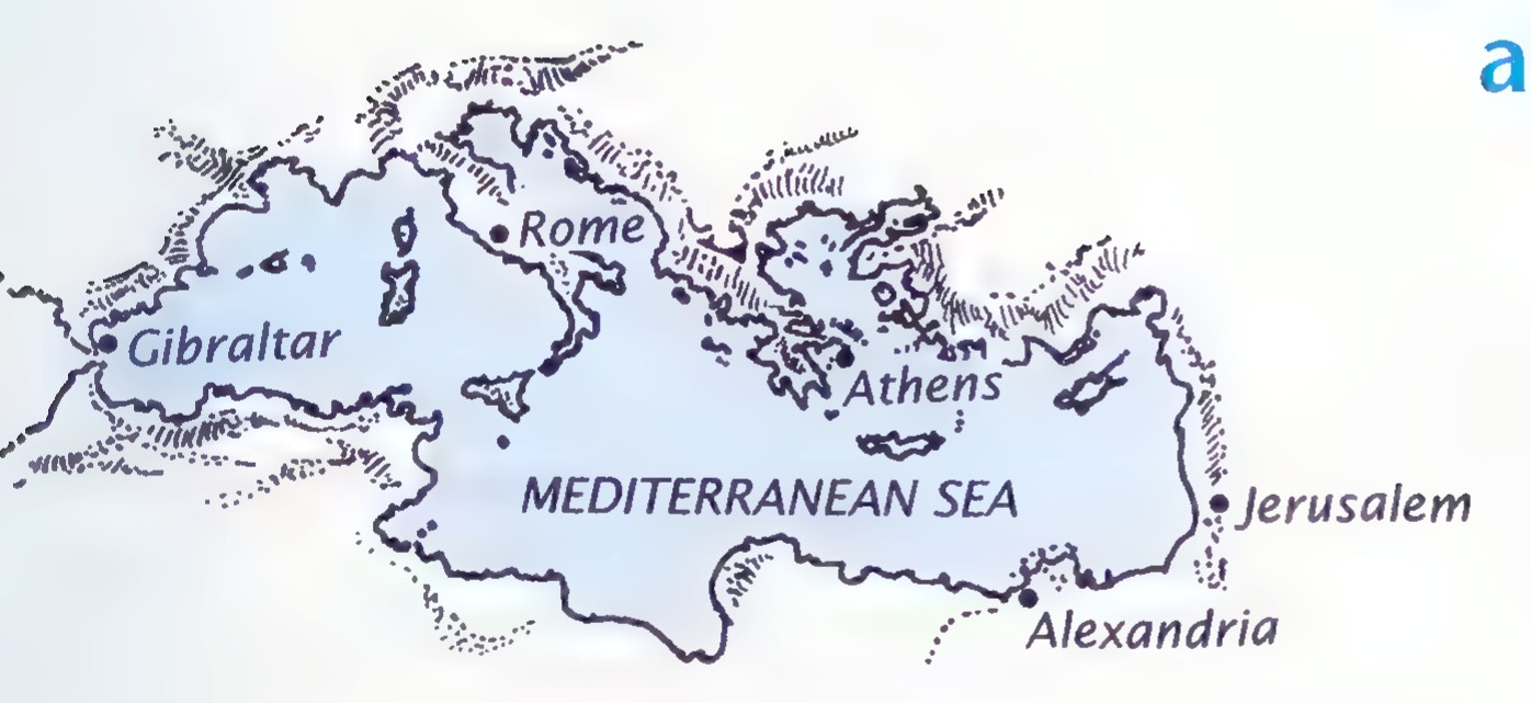
In about 300 B.C., a man named Euclid wrote what has become one of the most successful books of all time. Euclid taught at the university at Alexandria, the main seaport of Egypt, and his book, the Elements, contained much of the mathematics then known. Its fame was almost immediate. The Elements has been translated into more languages and published in more editions than any other book except the Bible.
The poem “Euclid” is reprinted with the permission of Macmillan Publishing Co., from Collected Poems by Vachel Lindsay. Copyright 1914 by Macmillan Publishing Co., renewed in 1942 by Elizabeth C. Lindsay.
p. 2
Although very little of the mathematics in the Elements was original, what made the book unique was its logical organization of the subject, beginning with a few simple principles and deriving everything else from them.
The Elements begins with an explanation of how to draw an equilateral triangle, that is, a triangle with three sides of equal length. Euclid’s method requires the use of two tools: a straightedge for drawing straight lines and a compass for drawing circles. These tools have been used to make geometric drawings called constructions ever since Euclid’s time.
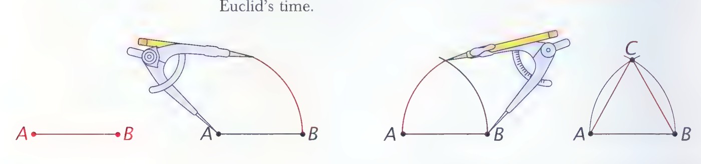
To construct an equilateral triangle, we begin by using the straightedge to draw a segment for one side. The segment is named AB in the figure at the left above. We set the metal point of the compass at A and adjust the compass so that the pencil point falls on B. The compass is now set to draw a circle with radius AB about point A. We draw an arc of this circle above the segment AB as shown in the second figure. Next we move the metal point of the compass to point B and, keeping the compass set at the same radius, cross the arc that we just drew with a second arc, as shown in the third figure. Finally, we draw two line segments from the point of intersection (labeled C in the last figure) to points A and B to form the triangle.
Exercises
- Use a ruler to draw a line segment 12 centimeters long and then use a straightedge and compass to construct an equilateral triangle having this segment as one of its sides.
Next, we will consider two geometric problems about equilateral triangles. To make them easier to understand, they will be presented in the form of a story.
The Puzzles of the Surfer and the Spotter
One night a ship is wrecked in a storm at sea and only two members of the crew survive. They manage to swim to a deserted tropical
p. 3
island where they fall asleep exhausted. After exploring the island the next morning, one of the men decides that he would like to spend some time there surfing from the beaches. The other man, however, wants to escape and decides to use his time looking for a ship that might rescue him.
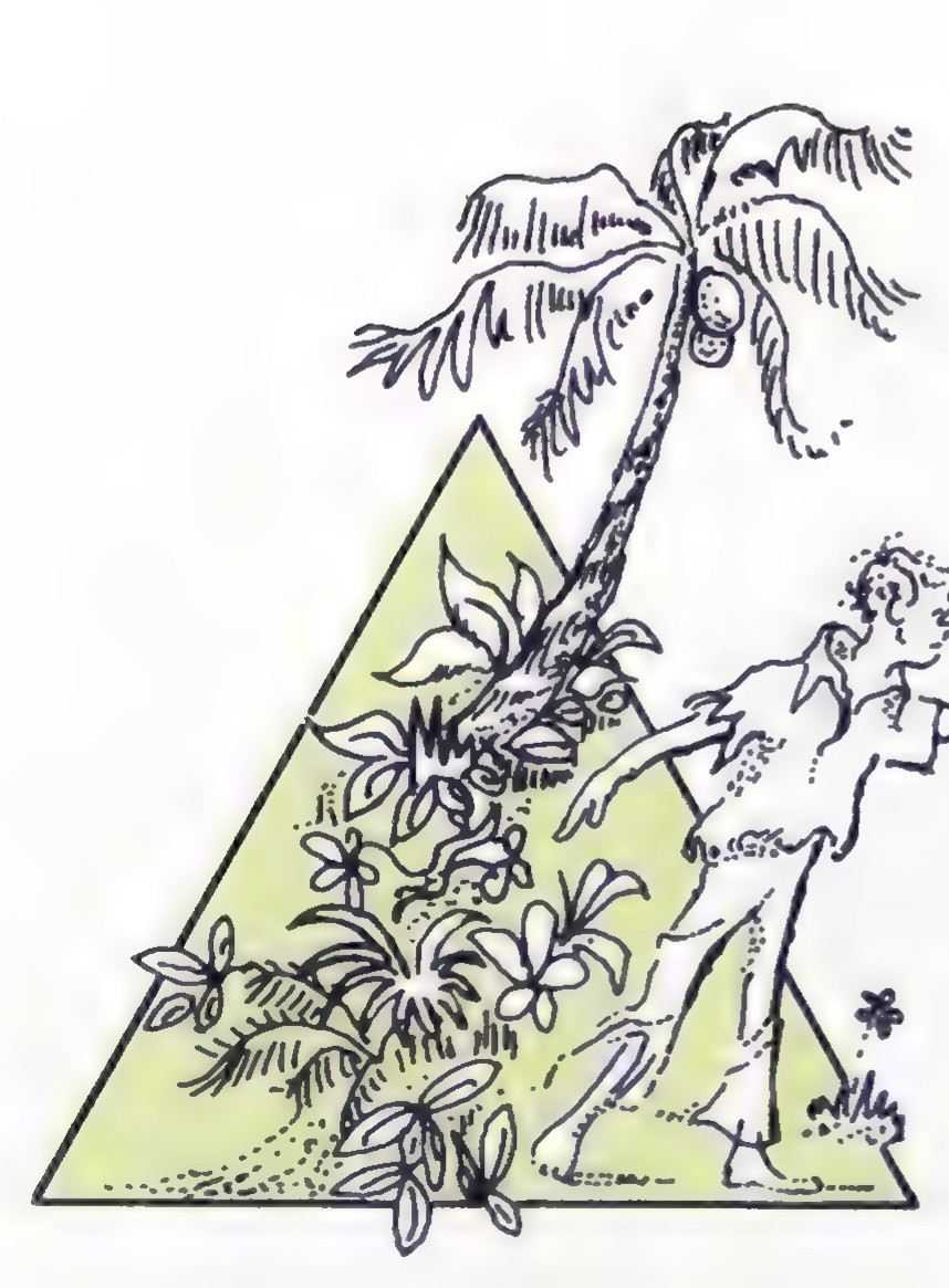
The island is overgrown with vegetation and happens to be in the shape of an equilateral triangle, each side being 12 kilometers (about 7.5 miles) long.
Wanting to be in the best possible position to spot any ship that might sail by, the man who hopes to escape (we will call him the “spotter”) goes to one of the corners of the island. Because he doesn’t know which corner is best, he decides to rotate from one to another, spending a day on each. He wants to build a shelter somewhere on the island and a path from it to each corner so that the sum of the lengths of the three paths is a minimum. (Digging up the vegetation to clear the paths is not an easy job.) Where should the spotter build his house?
The figure below is a scale drawing of the island in which 1 centimeter (cm) represents 1 kilometer (km). Suppose that the spotter builds his house at point D. The three paths that he has to clear have the following lengths: DA = 4.4 km, DB = 9.1 km, and DC = 7.9 km. Check these measurements with your ruler, remembering that 1 cm represents 1 km. The sum of these lengths is 21.4 km.
If the spotter builds his house at point E, the path lengths are: EA = 10.4 km, EB = 5.1 km, and EC = 6.9 km, and their sum is 22.4 km. So point D is a better place for him to build than point E. But where is the best place?
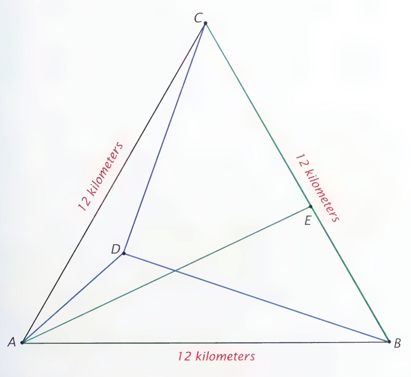
p. 4
- Use the equilateral triangle that you drew in the first exercise to represent the island. Choose several different points on it; for each point, measure the distance between it and each of the corners to the nearest 0.1 cm, and find their sum, as illustrated for points D and E on page 3.
- On the basis of your work in exercise 2, where do you think is the best place for the spotter to build his house? And how many kilometers of path does he have to clear? (Remember that 1 cm on your map represents 1 km.)
- Where do you think is the worst place on the island for the spotter to locate? How many kilometers of path would he have to clear from it?
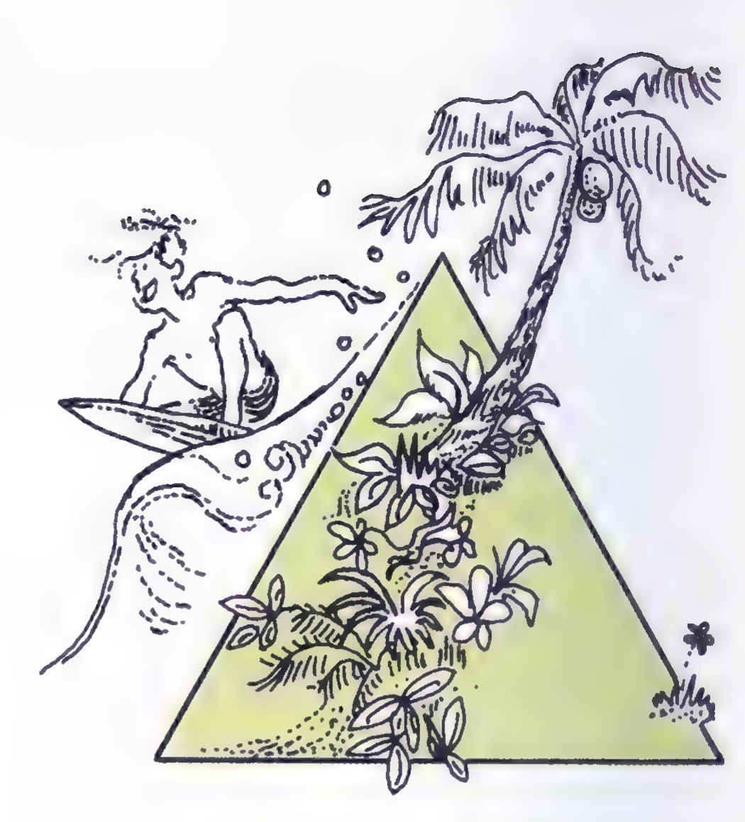
Now consider the problem of where the surfer should build his house. He likes the beaches along all three sides of the island and decides to spend an equal amount of time on each beach. To make the paths from his house to each beach as short as possible, he constructs them so that they are perpendicular to the lines of the beaches.
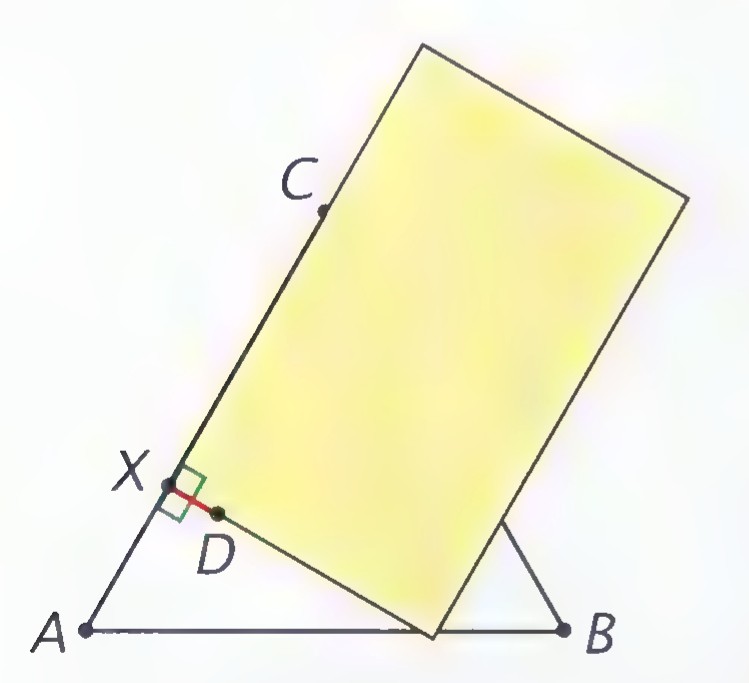
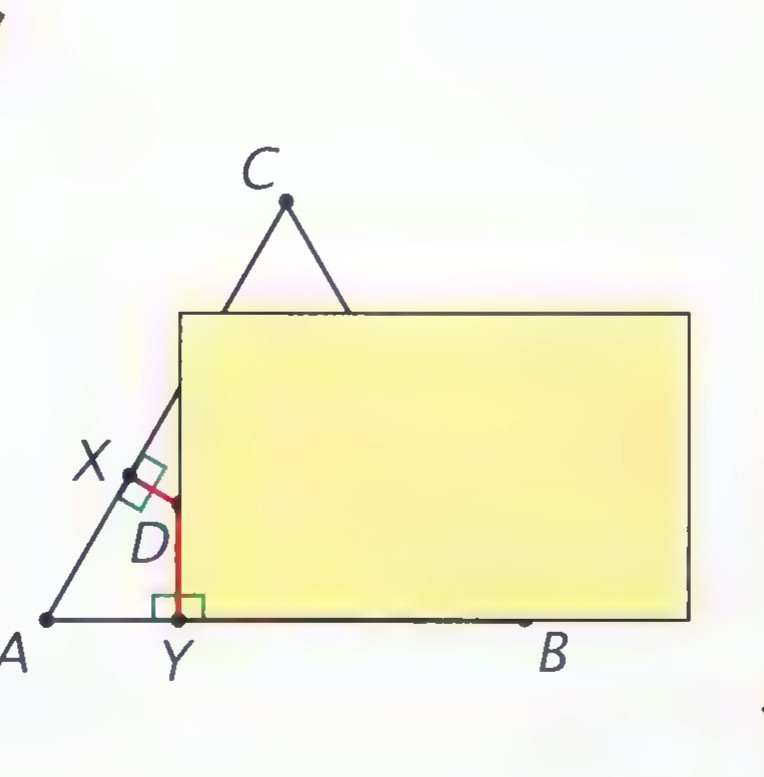
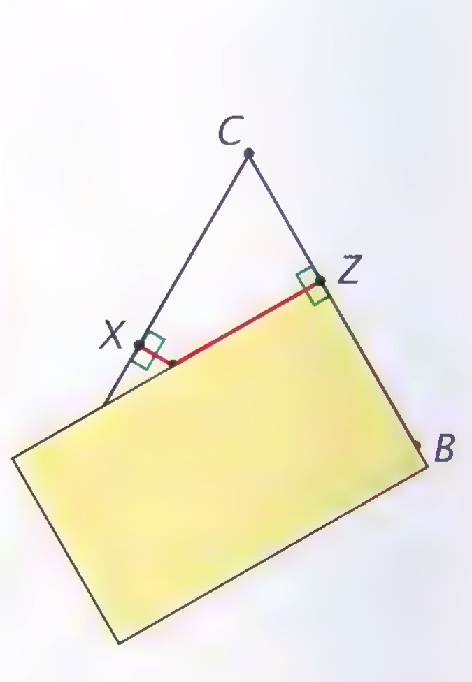
Perpendicular lines form right angles, 90 degrees (90°) on a protractor or the angle formed by the edges of a file card. An easy way to draw a line that is perpendicular to another line is to use a file card as shown in the figures below. Small squares are usually used to indicate that lines are perpendicular.
p. 5
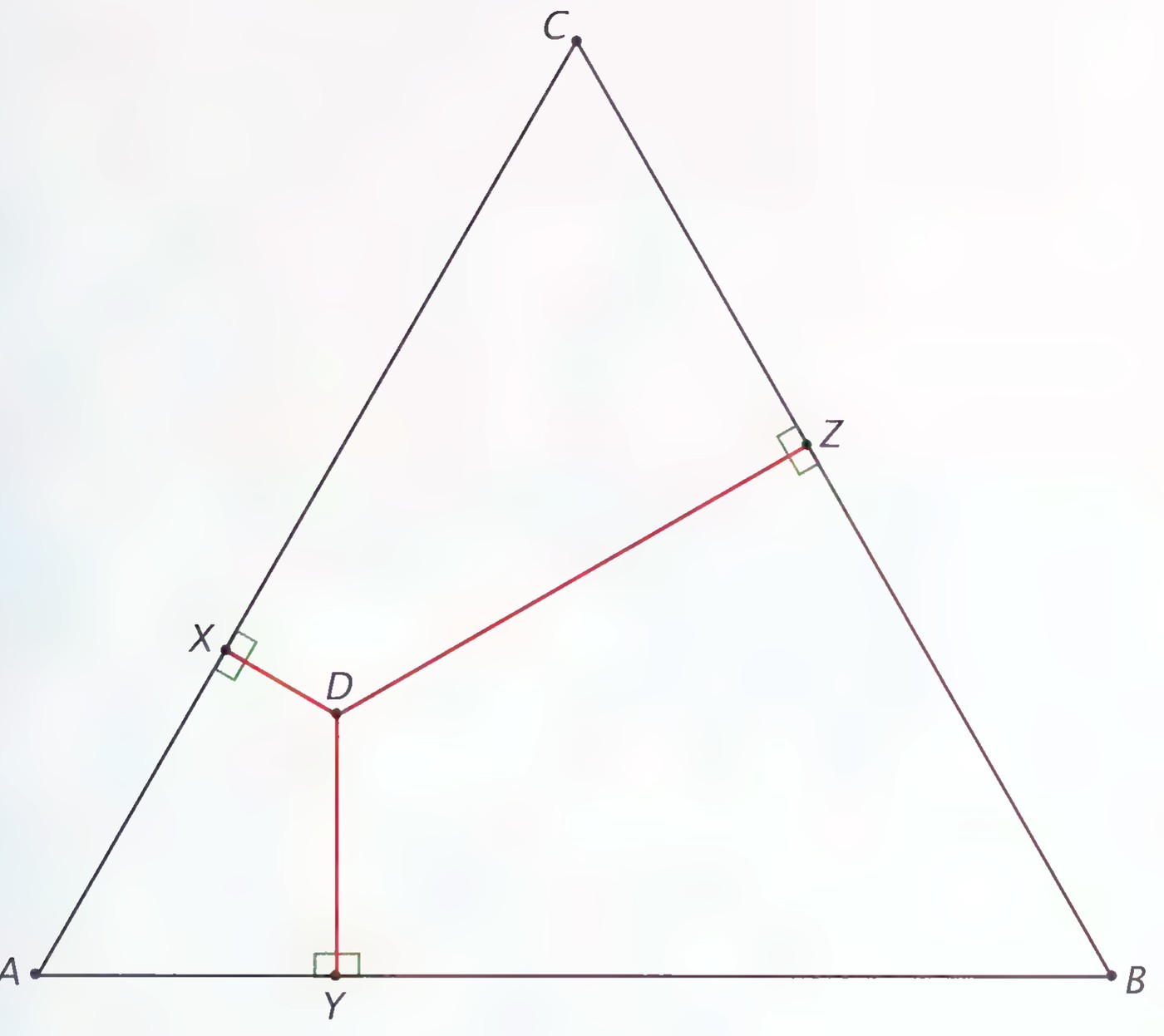
In the figure above, if the surfer built his house at point D, the three paths to the beaches would be as shown. Path DX is perpendicular to beach AC, path DY is perpendicular to beach AB, and path DZ is perpendicular to beach BC. The lengths of the three paths are: DX = 1.4 km, DY = 2.9 km, and DZ = 6.0 km; so their sum is 10.3 km.
The surfer, like the spotter, wants to locate his house so that the sum of the lengths of the paths is a minimum. Where is the best place on the island for him?
- Use a straightedge and compass to construct another equilateral triangle whose sides are 12 centimeters long. Choose several different points on it; for each point, measure the perpendicular distance from it to each of the sides to the nearest 0.1 cm, and find their sum as illustrated for point D above.
- On the basis of your work in exercise 5, where do you think is the best place for the surfer to build his house? And how many kilometers of path does he have to clear?
- Where do you think is the worst place for the surfer to locate? How many kilometers of path would he have to clear from it?
p. 6
Inductive Reasoning
In thinking about the puzzles of the surfer and the spotter, you first collected some evidence—you made drawings and measured them. Then you looked for conclusions based on what you had observed.
This method of reasoning is used in both science and mathematics. You will be using it throughout this book. The scientist who makes observations, discovers regularities, and formulates general laws of nature calls this process the scientific method. Mathematicians refer to it as inductive reasoning. It is the method used for drawing conclusions from a limited set of observations.
We use inductive reasoning regularly in everyday life. Its conclusions are generally reliable and useful, but they are sometimes wrong. For this reason, scientists call such conclusions conjectures.
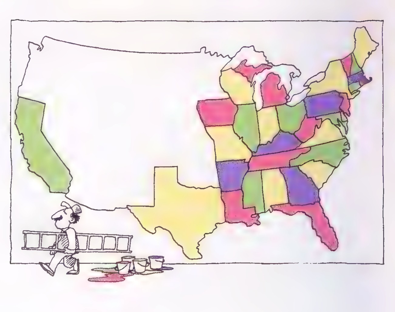
In 1852, a young English mathematician named Francis Guthrie noticed that he could color every map that he could draw or had seen with only four colors in such a way that no two regions having a common border were the same color. The map of the United States of 1852 shown above is an example. Many people tried to draw maps that would require more than four colors, but no one succeeded, which seemed to confirm that “four colors suffice” but did not prove it.
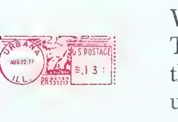
In 1976, more than a century after Guthrie made his conjecture, Wolfgang Haken and Kenneth Appel proved that Guthrie was right. To celebrate Haken and Appel’s proof, the University of Illinois used the postage-meter message that you see here. The method that they used, deductive reasoning, uses logic to draw conclusions from statements already accepted as true.
In addition to using inductive reasoning throughout your study of geometry to discover what is true, you will also learn how to reason deductively to be able to understand why.